
Featured Hike – Glendalough (Derrybawn and the Spinc).

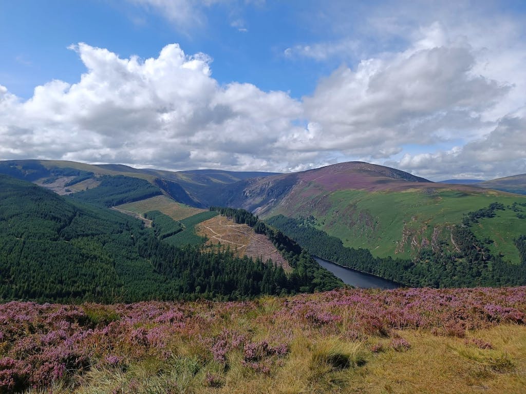
Glendalough sits in the Wicklow Mountains are a range of granite hills a short drive south of Dublin on the east coast of Ireland. Shaped by the glaciers that covered this land more than 12,000 years ago, they are now a series of rounded mountains and ‘U’ shaped valleys that rise to a high point of 940 metres but are more typically 600-800 metres high.
The poor nutrient levels of the thin soils and the dense peat that covers much of the hills, coupled with the high rainfall that leaches out what nutrients remain and forms an impenetrable ‘ironpan’, results in a sparse heathland cover of heather, sedges, bilberries and mosses.
Wild deer and a few sheep graze these hills, cropping the low vegetation and preventing tree regeneration. The lower slopes are forested with commercial conifer plantations, their dark interiors dripping with wet mosses and lichens, whilst a few areas of ancient oak and birch woods remain, and are now protected.
The Glendalough valley is a great place to start a hike, there is good parking, facilities and plenty of food and drink outlets. The waymarked paths can get crowded here on holidays and weekends, so this hike takes us away from the popular routes and onto a scenic ridge walk, with great views all around.
Glendalough translates from the Irish as the ‘glen of the two lakes’. Originally one lake, over time sediment from a stream flowing into the lough has eventually dammed it and cut it in two.
Our hike starts from the visitor centre, where we follow the ‘Green Road’ as it winds along the side of the valley through ancient woods preserved originally by the monks of the nearby monastery. We soon leave this behind us as we head up a narrow track through more oak and birch woodland to reach open country.
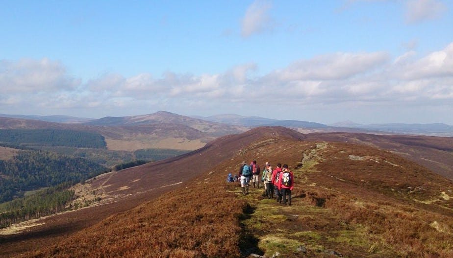
Our route now takes us steeply upward through heathland and pine plantation to the top of Derrybawn (482m), the start of the ridge and a wonderful place to enjoy the views of the sea, hills, valleys and mountains that surround us.
After taking in the views and catching our breath, we follow the ridge southwest, and as it broadens out we turn north west to take in our highpoint for the day, Mullacor, (from the Irish, Mullach Mhór, meaning ‘big summit’), at 657 metres (2,156 ft) high.
In the saddle beyond the mountain our path is crossed by the Wicklow Way long distance trail, here there is the shelter of some trees, and a good place to break for lunch.
Continuing on our way, we follow a track that traverses around part of Lugduff hill before we join a wooden boardwalk path at the top of the steep cliff that marks the southern side of the glaciated valley of Glendalough.
This is the Spinc, and from here there are stunning vistas both east and west along the valley, with dizzying views down to the lake 400 metres below.
Heading east now we follow the boardwalk along the cliff top until it descends into woodland and past the beautiful Poulanass waterfall before reaching the valley floor.
From here we can return to the visitor centre, but not before we linger a while at the ancient ruined monastic settlement with its iconic round tower. Founded by St. Kevin, and built in the 9th– 12th century, these ancient early Christian buildings attract many visitors and are a major attraction in Glendalough.
This hike and many more can be found on website Mountaintrails.ie