
Hill Skill Series – Understanding grid references

A grid reference is a series of letters and numbers that defines a unique square on a map, the more digits used the greater the accuracy and the smaller the square. Every country has its own unique grid, the lines are aligned north-south and east-west, forming a series of squares.
In Ireland the grid is divided into squares 100 kilometres x 100 kilometres (1 kilometre is a thousand meters).
There is a datum point set off the south west coast, which defines the 0 point, and each 100 km square is measured from here. The Irish grid is 500 km x 500 km and gives 25 squares in total.
Each square is represented by a one letter code, with the exception of I, which could be mistaken for the number 1.
These 100 km squares are then subdivided further into smaller squares, each one being 1 kilometre across.
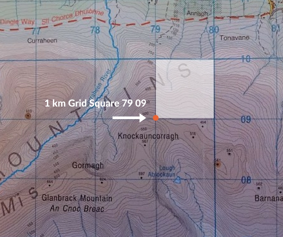
These 1 km squares are depicted on maps as blue numbered lines running north-south and east-west respectively. They are individually labelled using the ascending numbers 00, 01, 02, 03 etc… all the way up to 99.
The numbers along the bottom of the map, which increase towards the east are called Eastings , those numbers that are running up the side of the map and increase towards the north are called Northings.
When writing down a grid reference we first quote the Eastings then the Northings.
This can be more easily remembered by the saying ‘along the hall and up the stairs’.
We can define a given 1km square by first giving the 100km square box letter and then the 2 numbers for the Eastings followed by the 2 numbers for the Northings.