
Featured hike – Galtymore and the Cushnabinnia Horseshoe

Grade: STRENUOUS Time: 6.5 hours Distance: 13 km Height gain: 1040 metres
Galtymore is the highest inland mountain in Ireland and at 919 metres, is the 14th highest in the country. It sits squarely on the border between Tipperary and Limerick and forms a majestic centre piece for a tough horseshoe hike that takes in three great mountains, Cush, Galtybeg and Galtymore.
Galtymore is most often climbed from the south, via the black road, but this easier ascent misses out on the stunning views of the mountains north face, and of the several corrie loughs that sit under its imposing shadow.
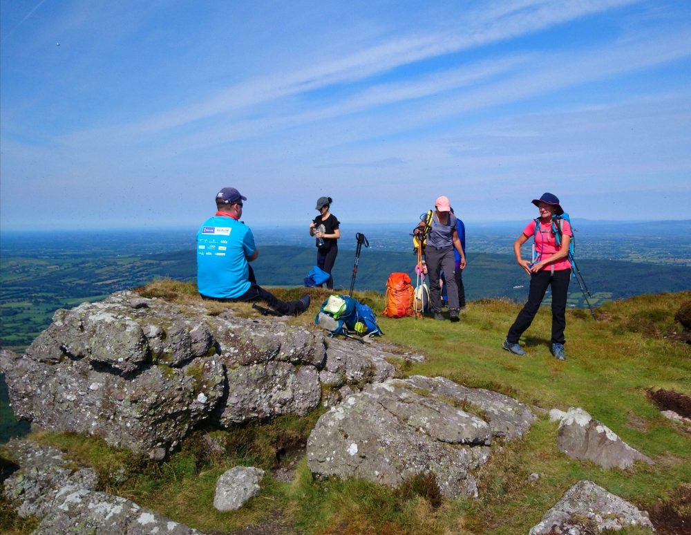
Taking a break on the summit of Cush, our first mountain.
Our route begins at the forest car park at Clydagh Bridge about 5 km west of Rossadrehid. From here follow the minor road uphill for a few hundred metres to a stile on the left that leads to a wide path over rising heathery ground. Continue uphill keeping the forest boundary to your left until you reach another stile, turn right here and ahead of you is a faint path that leads to the increasingly steep northwest spur of Cush.
Push on to the summit at 639 metres, where your route for the day unfolds before you and the mighty bulk of Galtymore dominates the valley.
Head south down the broad spur to reach a boggy saddle where before you lies the steep ascent to Galtybeg, a thigh burning 320 metres of steep grassy hillside and a somewhat daunting prospect. Stay strong, as the views from the summit of Galtybeg are stunning and the rocky crest gives ample shelter from any chilly westerly winds, making it a good spot for a lunch stop.
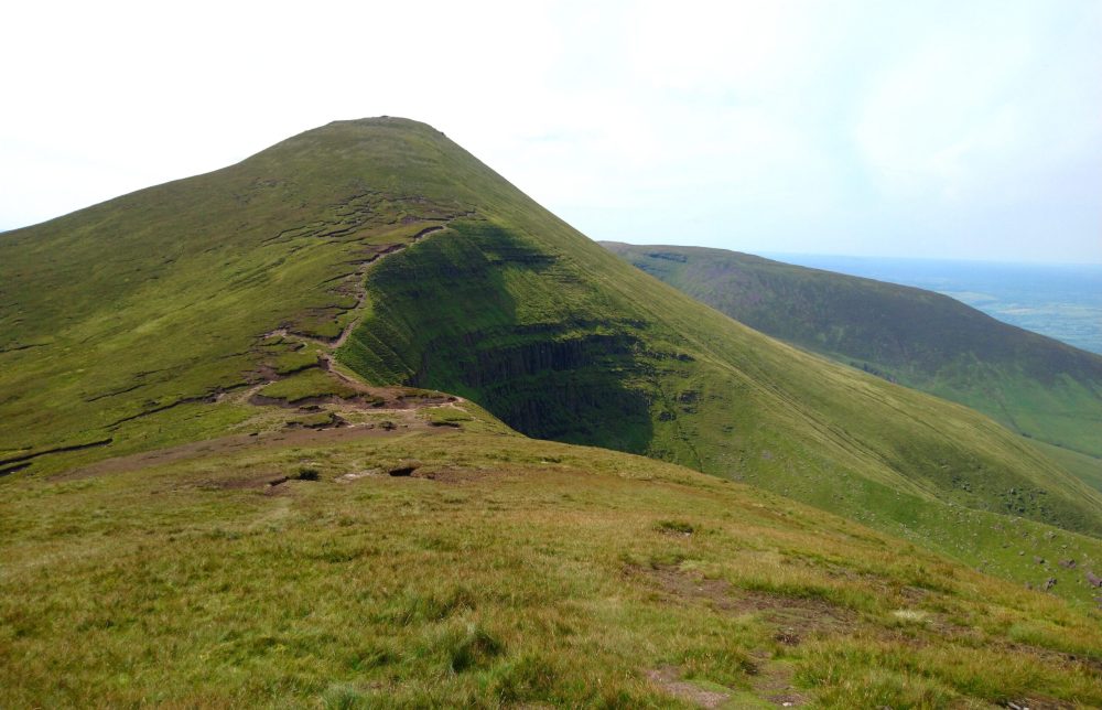
Galtymore from Galtybeg
When you are rejuvenated head west and down to the badly eroded and peaty saddle before another longish pull up Galtymore. At 919 metres this fine mountain qualifies as one of the Irish Furth’s (a mountain over 3,000ft), and is the county highpoint of both Limerick and Tipperary.
The elongated summit ridge is marked by a large cairn at each end, the first of these being the higher and the true summit. Between the two sits Dawson’s Table, a flattish area of sandstone conglomerate rock, upon which sits a much-photographed white Celtic cross around 2.5 metres tall. Spare a kindly word also for the recently erected small statue of Buddha sitting on a small plinth nearby.
A truly multi-cultural mountain!

The Cushnabinnia Horseshoe takes in Cush, Galtybeg, Galtymore and Slievecushnabinnia, a challenging day..!
Once the obligatory photographs are taken head west again to the second cairn before descending to a large boggy open area, bounded to the right by a steep drop and to the left by a stone wall. The wall acts as a navigation aid in poor visibility, and you can handrail it in a north-westerly direction until it funnels you towards the steeper ground below Slievecushnabinnia.
A faint path now leads you north, and gently rises before descending down the broad north spur of Slievecushnabinnia. In poor visibility care should be taken with your navigation here as it’s easy to lose the path on the hillside. Eventually you will reach a large cairn which marks the downward route on a clear path, follow this to a small hump and then follow post markers to the forest edge. Go over the stile and follow the well-made paths and forest roads back to the start point.
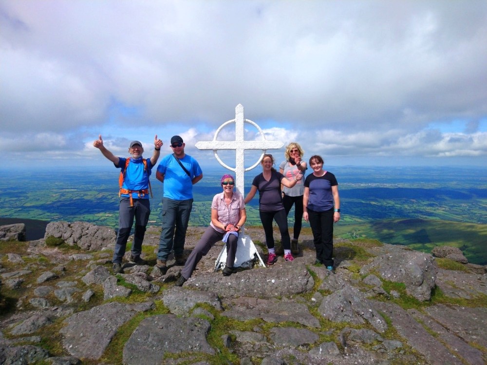
Galtymore summit cross
Mountaintrails guide hikes up Galtymore several times each year, you can find more details on their website at: https://mountaintrails.ie/hikes-beyond-wicklow/galtymore-cushnabinnia-horseshoe/